



Bộ Chữ Cái và Số In 3D: Giáo Cụ Học Tập Hấp Dẫn Cho Bé
 BygillisLikes121Downloads2.1K
Build another version of this model.
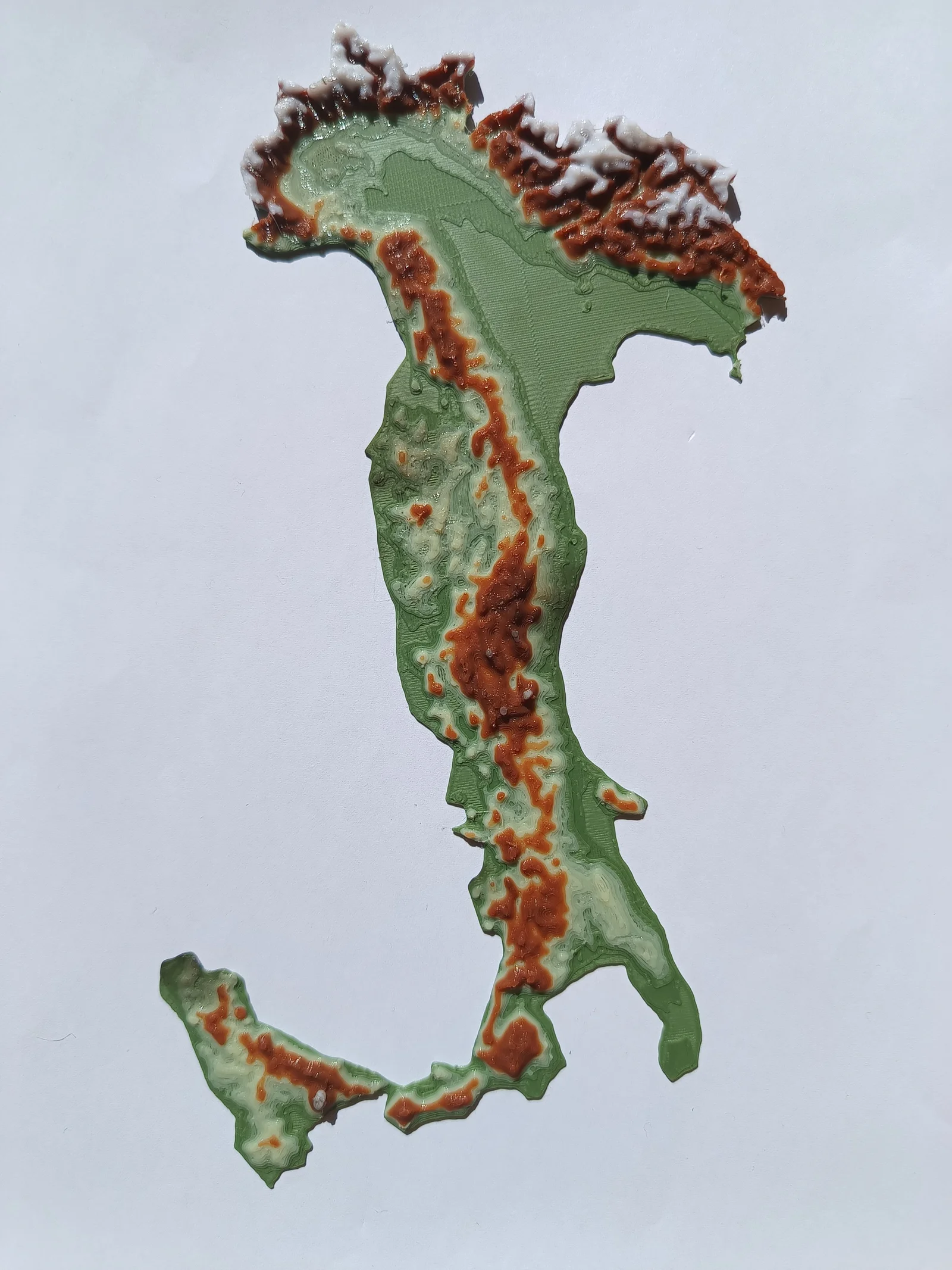
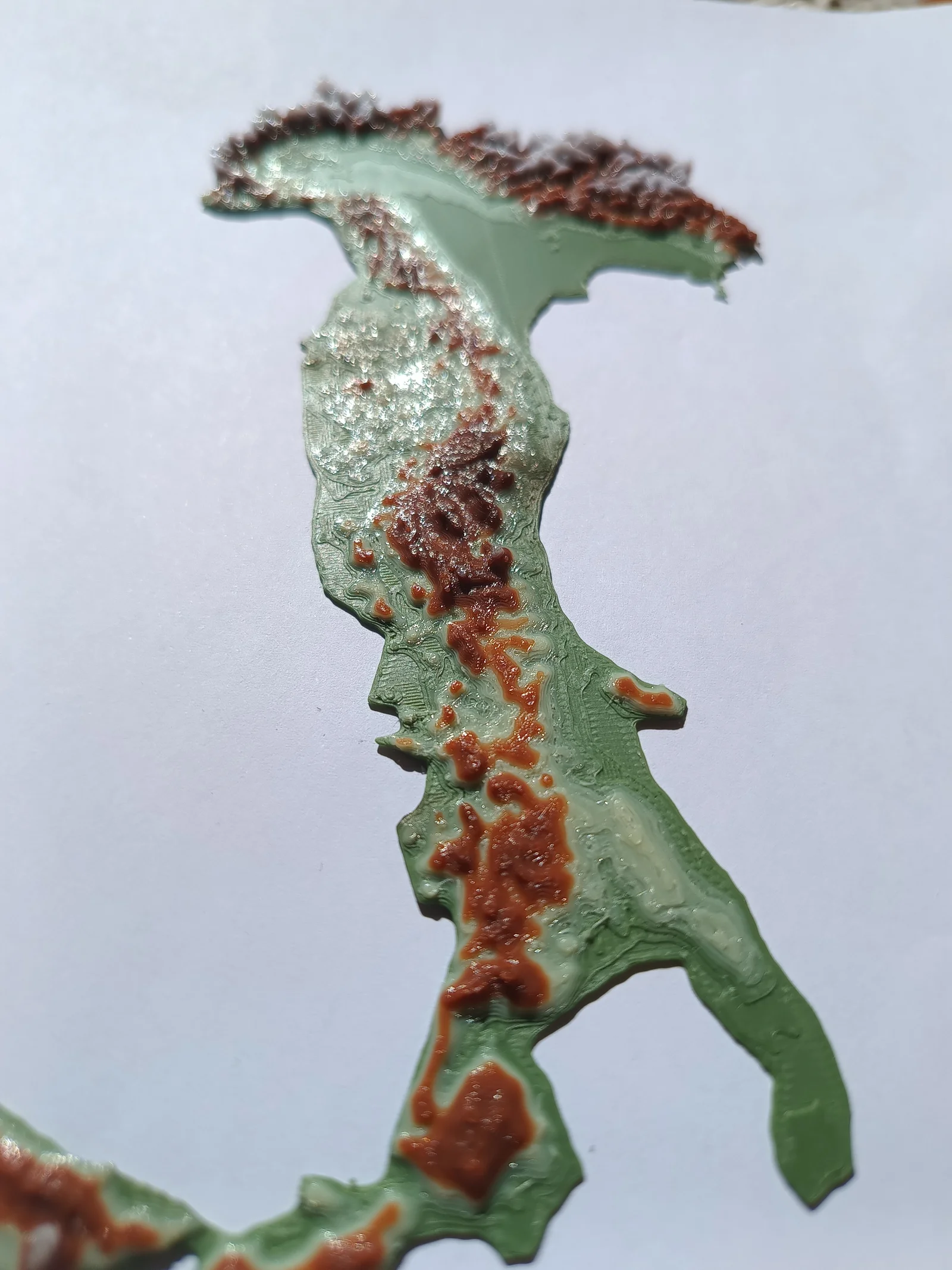
Colored terrain map of Italy, with or without ams.
Based on sattelite information.
I could never figure out what the maps were indicating when i was little. So i made one that i would have been delighted with as a kid.
As you print, if you don't have an automatic color changing system, I have implemented a few stops, based on height where you can change the color. It always goes Green, Yellow, Brown, White. This is the method these photos were achieved with.
Made with TouchTerrain (Welcome to TouchTerrain, the free web app for creating 3D printable terrain models! (iastate.edu))
Special Thanks to Neil and his video tutorial: Make 3D Printed Terrain Maps of Any Location for FREE! (youtube.com).
Happy Printing!
BygillisLikes121Downloads2.1K

 ByzoltanfLikes73Downloads277

 ByHonzalLikes246Downloads180

 ByBoonby_1059917Likes659Downloads1.2K

 ByFabianVeileLikes414Downloads1.5K

 ByATBOT_7809Likes16Downloads264

 Bytater-zoidLikes0Downloads111

 ByMarciLikes87Downloads295

 Bystrifu_4061046Likes151Downloads1.3K


 Byleizerdesign_249154Likes62Downloads802

 ByNickBuchele_1578568Likes58Downloads105