



Bộ Chữ Cái và Số In 3D: Giáo Cụ Học Tập Hấp Dẫn Cho Bé
 BygillisLikes121Downloads2.1K
Build another version of this model.
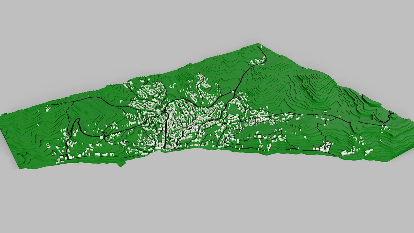
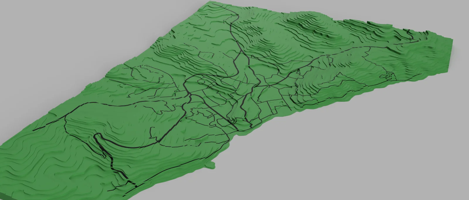
This is, by far, the stupidest idea I had in years (other than randomly writing a microbiology research paper, for which I actually learnt microbiology...). This is a 1 to 1 accurate topographic copy of a real existing city Alushta, which is in Crimea, Ukraine.
I have made it using Fusion 360, by hand drawing each layer of topography. YES, I am crazy. Although the roads are not to size, they are there to display the actual placement of REAL roads.
SIDE NOTE: I am not an Urbanist, nor am I an Architect or Geography enjoyer. I literally made this thing so I can 3d print it and put it on my table to look at from time to time (spoiler, I did not print it yet).
If you are an educational institution studying landscape of that city, you can use this topographic map easily, as it has an accuracy of +- 5 meters for each of the bands on the map. Considering the fact that the whole map has a highest point of 218 meters, that is an error rate of +- 2.3% which is incredible.
The scale of this map is 10 meters to 1 mm (10 meters of real landscape is 1 mm on the map) in terms of height.
The map is 5.5 km by 4.33 km wide.
Now to the variant with buildings: They reflect accurate placement and geometry of buildings generally, however, I can not guarantee you that the dimensions are accurate and to the scale. Especially height, it is not accurate at all. This is the last version of this project, as I am now satisfied with the results.
It could've been done better, but I did it the stupidest and simplest way possible. Have a nice day.
(Also, the version with buildings is called Alushta_Topographic_Map_Boodunku, as Будинки in Ukrainian (which sounds something like Boodeenkee in English...) means Buildings lol.)
BygillisLikes121Downloads2.1K

 ByzoltanfLikes73Downloads280

 ByHonzalLikes246Downloads183

 ByBoonby_1059917Likes659Downloads1.2K

 ByFabianVeileLikes414Downloads1.5K

 ByATBOT_7809Likes16Downloads266

 Bytater-zoidLikes0Downloads113

 ByMarciLikes87Downloads297

 Bystrifu_4061046Likes151Downloads1.3K


 Byleizerdesign_249154Likes62Downloads804

 ByNickBuchele_1578568Likes58Downloads106