



New
Whole alphabet
 Byandrej-bLikes0Downloads178
Build another version of this model.
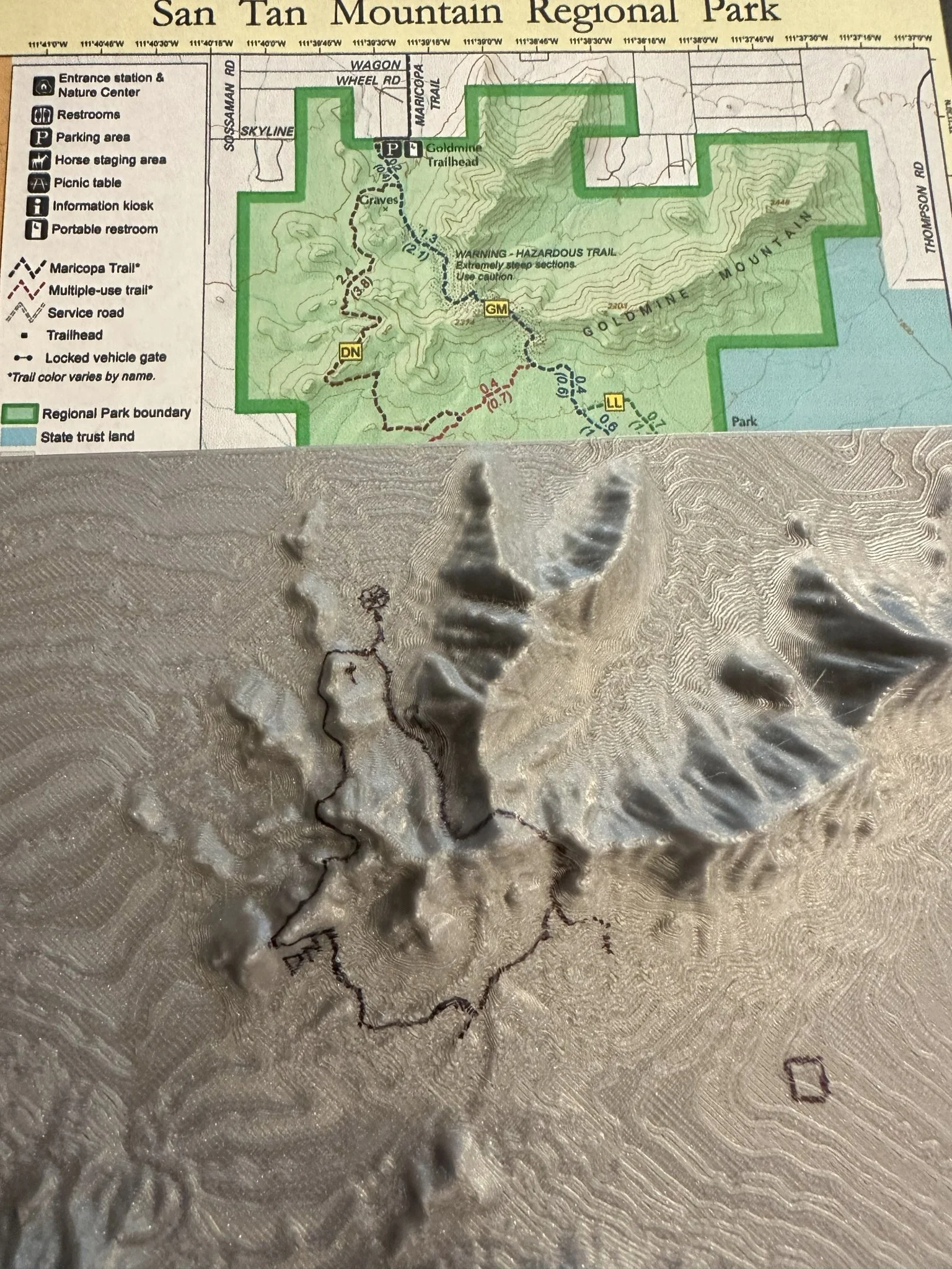
San Tan Regional Park is a hiking/biking/horseback riding area near Phoenix Arizona. I hike a fair amount there and thought it would be cool to make a 3D map of the park. Fortunately, I found a wonderful project out of Iowa State University published on the web. Click on the touchterrain link below, then click the map, search for a location, and set your parameters (each parameter is explained well with popups after hovering on the button). An STL output file is generated for you to use.
I set the parameters according to the Prusa MK4, set a 2mm base thickness (it's solid), and added a 2x vertical exaggeration to make it pop. Once the file is generated you can preview in your browser, or save the zipped file.
https://touchterrain.geol.iastate.edu/
Developed by Chris Harding Dept. of Geological and Atmospheric Sciences, Iowa State University and Franek Hasiuk, Kansas Geological Survey.
Byandrej-bLikes0Downloads178

 BygillisLikes121Downloads2.1K

 ByzoltanfLikes73Downloads280

 ByHonzalLikes246Downloads183

 ByBoonby_1059917Likes659Downloads1.2K

 ByFabianVeileLikes414Downloads1.5K

 ByATBOT_7809Likes16Downloads266

 Bytater-zoidLikes0Downloads113

 ByMarciLikes87Downloads297

 Bystrifu_4061046Likes151Downloads1.3K


 ByactualnameLikes0Downloads383