



Marci's Mount - Ngàm in 3D cho kính thiên văn Hadley
 ByMarciLikes87Downloads300
Build another version of this model.
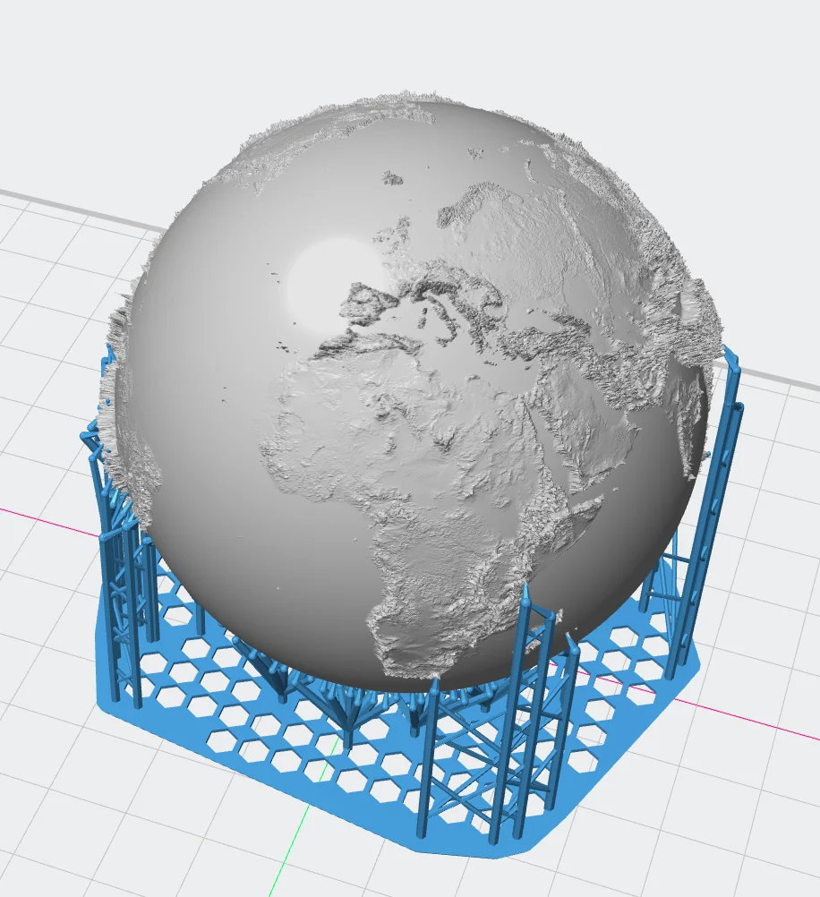
I created this model of earth using GIS (Geographic Information System) data. To model it I used the tools QGIS and Blender.
The height map used has a resolution of 3600x1800 points. I used such a high resolution to allow the model to be used for SLA (resin) printing.
The title picture shows this as a small ball of roughly 3cm diameter.
In case you are interested in the data source, it is available at:
Danielson, J.J., and Gesch, D.B., 2011, Global multi-resolution terrain elevation data 2010 (GMTED2010): U.S. Geological Survey Open-File Report 2011–1073, 26 p.
Print settings:
- Material: Resin
- Layer: 0.05mm
- Supports: yes
Made with passion by Xargas! Like what you see? You can support my work and help me create more awesome stuff via club membership or by purchasing one of club models.
ByMarciLikes87Downloads300

 Bystrifu_4061046Likes151Downloads1.3K

 ByBoonby_1059917Likes659Downloads1.2K

 Byandrej-bLikes0Downloads180

 ByFabianVeileLikes414Downloads1.5K

 BygillisLikes121Downloads2.1K

 ByLat0102_256421Likes35Downloads144

 Byloykastj_145194Likes1Downloads71


 ByzoltanfLikes73Downloads281

 ByHonzalLikes246Downloads184
