


Mô hình Megalodon trong Sea of Thieves - Bản cải tiến chất lượng cao và cắt rời
 ByvexanixLikes168Downloads1.3K
Build another version of this model.
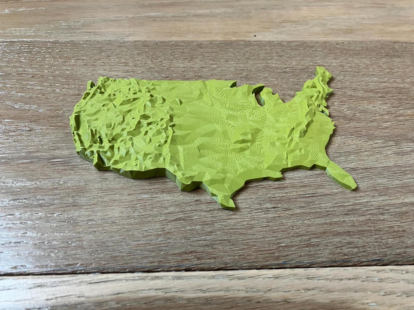
Low Poly edition of the USA Lower 48 States
In this model all elevations are square root scaled to reduce high elevation outliers and enhance low elevation detail. Find the full resolution USA lower 48 states combined here and print higher resolution individual state topo map models in USA of Plastic collection here.
File
Description
usa-lower-48-low-poly-0-1.3mf ⭐
Low Poly USA Lower 48
usa-lower-48-low-poly-0-2.3mf.3mf
2x more detail Low Poly USA Lower 48
You can scale the model up or down as needed to fit your printer size, the final map's scale will just be scaled accordingly. E.g. 200% scale on a previous scale of 0.4mm:1000m results in 0.4mm:500m
Pictured print was printed at 0.1mm layer height; model is detailed enough to be printed at higher or lower layer height depending on your preference.
Download the optimized Cura print settings profile for topo maps here.
Cartographic Specification
Value
Notes
Projection
USA Contiguous Lambert Conformal Conic
Horizonal Scale
1:25000000 (0.4mm:10000m)
Effective resolution is 500km x 500km (0-2 file) or 1000km x 1000km (0-1 file).
Vertical Scale
No linear ratio due to square root scale
Vertical exaggeration is ~3500x. Elevations are scaled on a square root scale to eliminate outliers at high elevation and bring out more detail at low elevation.
Maritime Boundary
N/A
Data: NASA, USGS, USCB
ByvexanixLikes168Downloads1.3K

 Bynonoobybut_3307010Likes364Downloads1K

 ByDrewmundLikes833Downloads4.6K

 ByPexPeppers Hot Sauce Hot SauceLikes114Downloads553

 ByFotisMintLikes71Downloads411

 ByAryserLikes36Downloads384

 Bythecodedkid_388190Likes219Downloads254

 ByFastRaccoon_718321Likes461Downloads1.5K

 ByCarlosAceves_395508Likes67Downloads295

 ByHaggiwatt_565243Likes25Downloads196

 ByTelles0808Likes78Downloads205

 By3DMakerSpace_4005643Likes43Downloads178